Showing posts with label train bridge. Show all posts

Thursday, July 06, 2017

Trip log - Cedar to Radiant: Canada Day - Day 1

We were prepared for the bugs. Did you know you can get a camping weather report that also gives you a bug report? Here's what it looks like:
For our weekend it was showing red for black flies and mosquitoes and green for deer flies. Preparation included carrying multiple bottles of Watkins bug repellent. We both carry a pump spray bottle and the cream (which I think is more effective). L.T. had a new spray he was trying out that was less toxic. I brought a new box of mosquito coils. And I carried the Thermocell with 2 butane cartridges and 4 of the strips. We both had bug hats, I wore mine pretty much the whole weekend, except inside the bug shelter and my hammock.

Conclusion? We're still both covered in bites. And the deer flies were out. I would have rated them just at the bottom of high activity. They will follow you out of a portage and join you in the canoe, sticking with you for the full paddle. I was wearing thick wool socks with my Keen sandals and they can very easily bite through wool, my ankles are the witness.

We've taken the mid-June trip off our schedule this year because of the intensity of the bugs. The Canada Day trip might go the same way.

As mentioned in the timetable post, we set off on our drive, got our permit, got to the access point, loaded the canoe and set off at 10:30 a.m. We had a long paddle down Cedar Lake. 
Today's route in purple (Jeff's maps)

Access point at Brent

Not a sunny day, but calm
We made good time going across the lake to the first portage point at the southeast part of the lake. We landed around noon. The lake was kind to us and wasn't very choppy. There wasn't really much of a breeze. The weather was ominous though. The forecast had said rain would start around 10 and by 2 we'd be having thunderstorms. 
First portage, beginning
It's also a campsite

Easy landing

Deceptively nice beginning
The first portage goes around the Petawawa River rapids called Cedar Lake Rapids. It's a nice landing; there are two campsites at this portage end and they're not bad if you don't mind some through traffic. The second one is particularly nice and looks out over the waterfalls (although I didn't take the time to have a close look). The first portage isn't too bad. It starts off quite nicely, there's one boardwalk over a creek, then it does get hilly and rocky. The Petawawa River is mostly in a gorge. The sides are steep and rocky, which makes for portages that involve going up and down with lots of rocks and some pretty steep put-ins and take-outs.

The portage is 960 meters and puts in below the last of the rapids. The sides of the river are high here and a couple of streams gush into the river. It's hard to see them though, the mouths seem to be protected by trees. The current is pretty strong if you chose not to paddle too heartily, you'd eventually get pushed to the next portage take-out. We did paddle though. The water was really dark today, the dark skies contributed to that. 
Petawawa River
Looking ahead


Looking back
After paddling about 1.5 km we were at the start of the next portage, 685 meters going around Surprise Rapids. Taking a rest on the portage with the bugs so furious isn't much fun. I was finding my bag a bit heavy so L.T. suggested we double-carry this portage. For the first trip I carried my fanny pack and the lunch backpack. It was an up-and-down portage, rocky, and shortly after the starting point, there was a muddy, swampy section about 5 paces across. For our first trip through, I bushwhacked around it, still getting my feet wet. Ick. We got to the end, it's a campsite. A really bad campsite. But I'm sure it's there to help people that aren't making good time and really need to stop and just stay somewhere for the night. It's a big rock with maybe only one flat grassy spot about the size of a pup tent. 

We dropped what we were carrying and retraced our steps. Again I did a loop through the undergrowth to go around the water on the trail. I picked up my backpack, fit my hands into my trekking poles, and started the final trip on this path. My poles have a harness on them where my hands fit and they are velcroed in. When we got to the wet section, I tried my circuitous route and as I ducked under a fallen tree, my backpack got stuck. I tried to wiggle lower and lower then fell onto the log below on my stomach, both of my trekking poles collapsed into half their size in front of me while getting wedged into the muck below. One forearm also ended up in the mud. L.T. had to come over and help me out. With both hands locked into the poles I had no ability to extricate myself.

It had started raining too. This was a miserable portage. As we got to the end, thunder and lightning could be heard. We decided to wait it out a bit then the skies opened and it just poured for 15 minutes. We were both drenched completely through right to underwear. Finally L.T. wedged the canoe into a Y in a tree and we stood underneath that. We were getting a bit concerned about the time, so we set off while some thunder was still rumbling in the distance. At least the rain had stopped. We had eaten some of our lunch during this wait. One bonus of torrential rain, the bugs weren't able to fly around.

There's not a very far paddle to the next portage, probably half a kilometer. A train bridge comes into view and a stoney path up the side of the hill leading to the train bridge is visible. The real portage is about 50 meters further. We took the train bridge route. It's a serious straight-up scramble. This portage goes around Devil's Chute Rapids. And there's a section at the end called "Five Man Grave". I was very glad we were going around this section of the river!
Looking across the bridge

The path coming up to the track

Bridge close-up
NOTE: Algonquin Park does not recommend using the rail bed for portaging. 
Waiting for L.T. to join me
L.T. cut me a break and I just climbed up to the rail bed with my life jacket, the lunch and my poles. He brought me my pack. He made a second trip to get the rest of the gear and the canoe. I put my backpack on over my brand new rain poncho that has some sort of silicone coating. That was a bit of a disaster. Between the fanny pack flipped around to the front, the big backpack with my life jacket, the lunch bag and my camera bag attached to the back, would not sit properly on my hips. This is important to distribute the weight evenly. My shoulders were taking all the weight instead of my hips and the pack was slipping around a lot. 

The majority of this informal 860 meter portage can be done on the tracks which is much easier than the down and up of the portage. Where that portage crosses the tracks, we had to turn onto it, off the track. But not for very far. 
Put-in at end of last portage

Marker for last portage

Smiling because I don't have to portage anymore today
Once the last portage was done for the day, the rest of it was just paddling. We had about 6-7 more kilometers to paddle and the current was going in our favour. The water in the river was so calm that as we turned a corner into a long, straight section, we had trouble figuring out what we were looking at. For example, a large rock outcropping looked almost like you could paddle under the rock reflection. A large tree root was sticking out of the river as well. From the distance it looked like jawbones of some huge shark.
At least it's not raining
We got out onto Radiant Lake, there are a few cottages at the mouth of the river, lucky folks that have those. There are 5 campsites along the top of the lake, we were hoping for the 3rd site. It was occupied. We decided to go to the 4th site. L.T. had been on the 2nd site on a previous solo trip and he said it was nice. But the 4th site might have a sandy beach, so we pressed on. The 3rd site is probably the best with a real sandy beach. The 4th has a sandy bottom with a pebble-filled beach. Still not bad. We landed around 5:30 p.m.

The site has a lot of straight red pines on it. They don't have a lot of lower branches. The sun was starting to peek out onto the site, there was a good spot to put the bug shelter and lots of trees to hang hammocks. We were home for the next 2 nights! The first thing we did was hang that bug shelter. 
Campsite pines (taken on Sunday)
When I opened my bag I was in for a rude awakening. Everything that was not in a dry bag was wet from the torrential downpour, including my air mattress. Oops! Lesson learned there.

Later on when L.T. was hanging the ropes and pulley for the bear hang, he could hear a fairly consistent peeping noise that he was struggling to identify. He followed the sound until he came to a hole in a tree. Ah, a nest of baby birds of some sort. He backed away and the local woodpecker came in to protect her babies.

Meals today:

Breakfast - L.T. made scrambled eggs, bacon, cheese and grape tomato wraps to eat in the car.

Lunch - L.T. prepared various deli meats, cut up some delicious old white cheddar, and had cut apples with plums and grapes. He also packed some crackers in his Thermos with some brie. But with the rain downpour we skipped that portion.

Dinner - L.T. had brought a fresh steak and veggie meal for tonight, but we were both too tired to go look for wood to burn. Besides with the rain, most of the dead fall would be wet. Instead we had Sunday's dinner which was deep dish pizza with rehydrated veggies, basil and garlic pasta sauce (also rehydrated), bacon, pepperoni and cheese. Dessert was raspberry fruit crisp (rehydrated raspberries, a bit of sugar and granola topping).

After dinner as we were sitting in the bug shelter, a whippoorwill sounded its call as it flew by. The park is recording sightings (or hearings) of that bird to try to get an idea of the population and where they are hanging out. We didn't hear many loons though. 

Today was Canada Day and for our homage to being Canadian: we were out in the Canadian wild and as for wearing the Canadian colours, we were both white-skinned with red bug bites. For fireworks we had fireflies flickering around the campsite. And there were no line-ups anywhere, even for the port-a-potty at the back of our campsite, unless bugs count.

Pictures:

When the going gets rough, the camera stays in its bag. I did take lots of pictures of the campsite on Sunday. Here are a few pictures:


Looking down the Petawawa River


The last 3 photos were taken on Sunday

Timetable                                   Day 2                                      Day 3

Monday, March 14, 2016

Le Petit Train de Nord - a cycling trip: Day 3

Today was going to be our biggest uphill day. We were riding from La Conception to Val-David. Fortunately the next night's B&B was going to be right on the path.

We were up early, ate a delicious breakfast, and were on the road at the usual time. It was a chilly morning today. I was glad to have cycling gloves.

Our bikes had been locked in a 3-sided shed by the driveway entrance. Not as secure as our very first night in St.-Jerome, but there would have been much less traffic going by here.

Today for lunch we stopped at a grocery store and sat at picnic tables out front. No duck fat today!
One of several very pretty train bridges
We would be cycling 54 km today, plus a few extra to get to the trail first thing in the morning. Our extra bit was on a very narrow paved highway. It had been nerve-wracking riding here yesterday with the busy Saturday traffic. But on Sunday morning, it was much quieter. 

We had a bright, sunny day today.

As anticipated, the hills were higher today. Well not only higher, but because of the gradual grade, they seemed to go on forever.

On one of the train bridges we climbed down to the river below. I found a special souvenir that I carried home and still have.


Railway spike souvenir (camera for scale)
We found our B&B very easily and this town, Val-David, was hopping. It is much closer to Montreal and I'm guessing there are lots of people that head out into this area for the weekend. We could tell when we had our first dinner out at a chichi restaurant that was freaking expensive. Oh well, one fancy dinner was called for on the trip.
The B&B from the river
Just a bit beyond our B&B on the trail, there was a farmer's market in full swing. We stopped over there to check it out before checking into our B&B. We had arrived and knocked on the door, but no one was home. So we explored a bit.
Embrace the ice cream!
Our B&B, the Maison de Baviere is a very interesting building. It originally was a shed to store wood for a sawmill. It is right on a lovely rocky river. I spent some time climbing around on the rocks in the afternoon. It is so picturesque and the sound of the water is so calming. There is also a small bridge beside the B&B. 
View from the B&B 

Pretty bridge, pretty river 
Hand-painted windows
The B&B website is: http://www.maisondebaviere.com/?lang=en

Our rooms were on the main floor from the road. However, this floor is the upper floor, with the dining room and living quarters of the hosts below us. The walls and were hand-painted in a German style. And there were a little pair of wooden shoes in the closet of my room. My room overlooked the river and I opened the river to hear the sound of it flowing over the round rocks.


Klompen


Overview              Day 1             Day 2              Day 4

Tuesday, December 01, 2015

Bridges - a picture post

It's December 1st, where did November go? I can still get my fix of gorgeous Algonquin photos from various Facebook posts by real photographers - how do they get so close to all those animals? How do they even find them? We have freezing rain coming our way, so even though there's no snow on the ground - it's not far away.

Here are some Algonquin Park pictures, specifically of bridges. All pictures were taken from the canoe or on a portage. Enjoy a little piece of summer!
Logging Bridge over the North River - looks brand new
Bridge over the Petawawa River - just before Narrowbag Lake
Train Bridge over creek going into Aura Lee
Train Bridge on Little Cauchon Lake
Train Bridge from Grand Lake into Stratton Lake
Train Bridge on portage between Maple Lake and Erables Lake

Wednesday, June 24, 2015

Trip Log - Day 1: Cedar Lake to Carl Wilson, June 2015

Day 1                      go to Day 2                      go to Day 3
Happy Birthday, LT!  We both booked Friday off and were headed up to the Brent access point.  LT made the reservations online and was surprised at how little company we would have.  No one else would be on Carl Wilson Lake the first night and only one other campsite was booked for the night we were going to be staying on Cedar Lake. 
The plan was to leave by 6 a.m.  That was the plan in order to get a quicker start on the day.  But the birthday boy had trouble getting his butt out of bed.  I showed up promptly at 5:30 and he tried to act like he hadn’t just rolled out of bed. Ha!
My breakfast strategy to accommodate the earlier planned departure time was to make egg salad the night before, put it into flour tortillas that morning, and just make tea to drink in the car on the drive with the sandwiches.  I had also filled the car with gas the night before in a torrential downpour to avoid having to stop for gas.
We missed the plan by half an hour, which wasn’t too bad.  We left at 6:30 a.m. and were at the permit office around 10 a.m.  It took another half an hour to get to the access point and half an hour again to unpack the car, load the canoe, and get it ready to launch.  There were only 3 other cars in the parking lot, the quietest I’ve ever seen that access point.
The thermometer display in my car had climbed to 14 from 12 degrees Celsius.  The sun was out, there were puffy clouds in the sky and the wind had subsided from 5:30 this morning where the trees were waving around quite noticeably.
More important than anything else Cedar Lake was playing nice this morning.  We would not be impeded by any wind or waves while we headed to the top of the lake.  I have a lot of respect for the bigger lakes.  You can’t count that the going will be easy or even reasonable. 
Brent Access Point - Gorgeous Day!
 We made good progress, starting on the North shore crossing the lake after about 15 minutes of paddling.  We passed close to a small island that was obviously claimed by seagulls.  They decided we were a risk to their kingdom and decided to fly around us, squawking loudly, trying to deter us away from their nesting grounds.  It was pretty funny mostly because none of them pooped on us.  They got braver as we moved further away.  Very much the bravado of the posturing bully when he realizes you’re not going to fight him.
We made it to the island at the top of the lake with a campsite and a chimney on it.  There obviously had been some sort of structure here at some point.  We stopped for lunch.  The paddle to get this far had taken a couple of hours.  We had a really good lunch this time mostly because there was no bread.  Cold meats, salami, cheese cut up and fruit (grapes, apple, and pear).  The site is really nice you have a view as far as you can see down Cedar Lake.  The site gets a lot of visitors by the looks of it.
Lunch Stop
LT turned to me and said “Guess what I forgot? I forgot dinner.”  I didn’t believe him.  He had made chilli earlier in the week, carefully selecting ingredients like hot Italian sausage.  He had frozen our portion and it got forgotten in the freezer.  We keep trying to cut down on the amount of food we’re bringing.  We always seem to bring some food back.  This trip we may not have much coming back.
Continuing on we set off through a small channel into Little Cedar Lake.  At the top of that lake you’re into a small river flowing out of Aura Lee.  It has a bit of a curve and you have to paddle under a cement train bridge that is a bit dark.  It has two openings but only one is passable.  
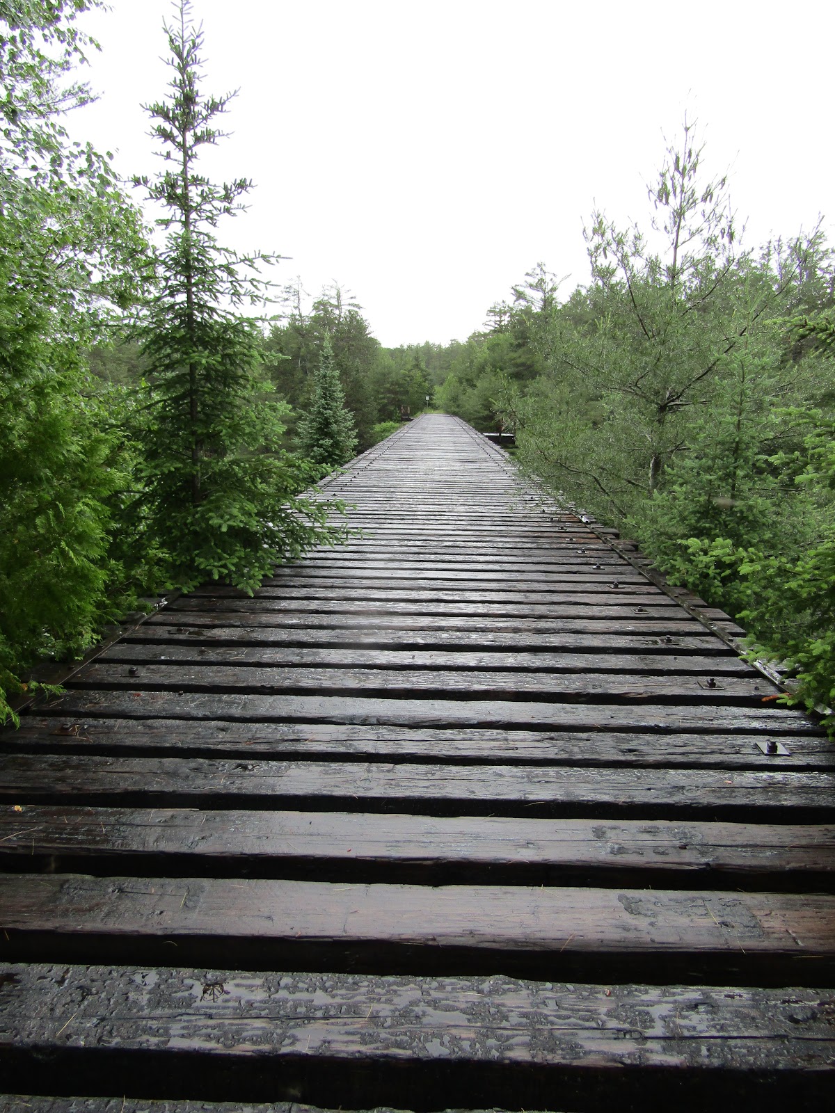
Train Bridge - going into Aura Lee Lake
There are a couple of campsites on Aura Lee.  At the top of the lake there is a creek dropping in, the portage we were taking was to the left of that.  345m. There’s not much of an incline on this portage.  It has round rocks as the base in a lot of spots you need to step carefully.  We did this as a double carry as it wasn’t very far.
The next lake is Laurel Lake and it has 5 campsites.  The first one we encountered is an island site, it looks nice.  The other 4 are along the top border of the lake and we didn’t pass very close to them.  As we were going around the corner to left of the lake we could hear water falling, but we couldn’t see the source.  I’m always wary around rushing water I would never want to propel myself over any waterfall!  When we found it we could see it was falling into the lake from a source with jammed logs.  There’s a dam there, but I’m not sure how far up the creek it is.  It is very pretty, surrounded by forest, you just get a peek at it.
Pretty Watefall - sounded scary from afar
The 130m portage was just to the right of the waterfall.  This portage was very uphill.  Even though it wasn’t far it was still challenging.  On our way in we did this as a double carry.  I was breathing very heavily after carrying my bag up the portage.  We put in at the bottom of Little Cauchon Lake.  Shortly after that we paddled under the second train bridge.  It is made of wood with only one of the four spots under the bridge passable.  It looks like this was opened specifically for canoe travel.  Also motorboats are allowed on this lake.
Train Bridge #2
We didn’t have to go far before reaching our last portage of the day, 1070m.  I bet in the fall this is a really lovely portage.  As you follow a slight climb with plenty of well-maintained boardwalks, a burbling creek tumbles down the terrain by the trail.  However in June there are hoards of blood-sucking insects just waiting for you to come by.  I had taken off my hoodie, I had on a long-sleeved white Columbia t-shirt with long pants, a bandana on the back of my neck, full gloves, and my bug hat.  The shirt is snug.  I got my backpack on, put my gloved hands into the harnesses of my trekking poles and set down the trail.  LT was doing a single carry on this one.  I was miserable.  The mosquitoes were biting me through my shirt in places I couldn’t reach even when I took my hand out of one of my hiking pole harnesses to swat at them. 
There is a canoe rest about halfway through this portage, I didn’t even see it on our first trip through here.  The map says there’s a spring there as well.  I was walking head down, arms flailing, lips swearing, trying to make record time through this torture.
The launch site at the end of the portage is decent. We were in a narrow section of the lake before it twists to the right and opens up.  It’s a pretty lake made prettier by the lovely sunny day we were having.  It’s obvious where the hardwood trees are on the West side of the lake.  We had already paddled by the first campsite next to a portage sign on the East side of the lake.  We landed at the next campsite on the West side to check it out. 
We were travelling with 3 structures on this trip.  The tent, the mosquito shelter and LT’s birthday present, a brand new Hennessy Hammock.  We didn’t need a flat spot to put the hammock, but the site was a bit hilly.  I was tired by now and even though it’d be nice to stop, being in the shade made the mosquitoes more annoying.  We pressed on.
The next campsite had potential.  It is on the East side.  The map showed another campsite close by so we went to check that one out.  It was around a point into a bay that was a bit marshy.  We went back to the previous site.  It turned out to be really nice.  The put-in wasn’t too bad, the site faced west, we were going to have a great sunset. 
Carl Wilson Lake
Priorities: the mosquito shelter went up first.  I started putting the tent up, although usually LT does it.  It’s his tent.  I set up right up front against the shore.  I had an unobstructed view of the lake.  The tent is a really nice one, it has doors on both sides which works really well when you’re sharing it.
Getting Settled In
The mosquito tent was just behind me and LT was setting up his hammock between two trees a bit further back on the site in amongst the bugs.  He didn’t try it out beforehand at home, this was his initial attempt at hanging it.  It’s an asymmetrical shape, a parallelogram.  I had purchased a set of snake skins which he chose to use with the fly instead of the hammock itself.  We put the fly up first.  Then we put up the hammock but it didn’t seem right.  It took two tries.  He spun the hammock 180 degrees.  He had to do the same for the fly, but only 90 degrees.  He had to take the snake skins off the fly and put them on the other ends. 
He will do a gear review at some point about the hammock with more information. 
Carl Wilson tucks us in
Dinner was late, we ate at 8 p.m.  We repurposed the next day’s lunch to be tonight's dinner.  We had Kraft Dinner with chicken pepperettes cut up and mixed in.  Dessert was pineapple pudding cake.  We had chocolate for an evening snack.  LT remembered his night caps and I had some Camino dark hot cocoa.  The sunset was awesome and the moon even more gorgeous.

I slept terribly.  It was the quietest night I’ve ever spent camping.  There were no leaves rustling, no waves lapping, no animals making any noise.  However it was chilly.  I hadn’t packed any extra warm clothing.  It probably went down to 9 degrees overnight.  Part of it was being in the tent alone.  I realize now that my air mattress is a narrow one.  LT has a much bigger one as he is so tall.  Both mattresses fill the bottom of the floor of the tent.  I never realized how much I spilled over onto his side during the night.