This is the first trip that we've used L.T.'s new vehicle, a Honda CRV, so we needed to learn how to best tie the canoe on. Spoiler alert, it took a couple of stops on the way home and several lost foam supports before it felt really solid.
On Sunday, July 8, 2018 we loaded up and headed to the Sand Lake Gate and parked the car at the Squirrel Rapids access point. Our plan was to paddle up to the second portage near Brigham Chute and walk up to that for lunch and a rest. We'd be paddling upstream on the way there and downstream on the way back.
 |
| Jeff's Maps |
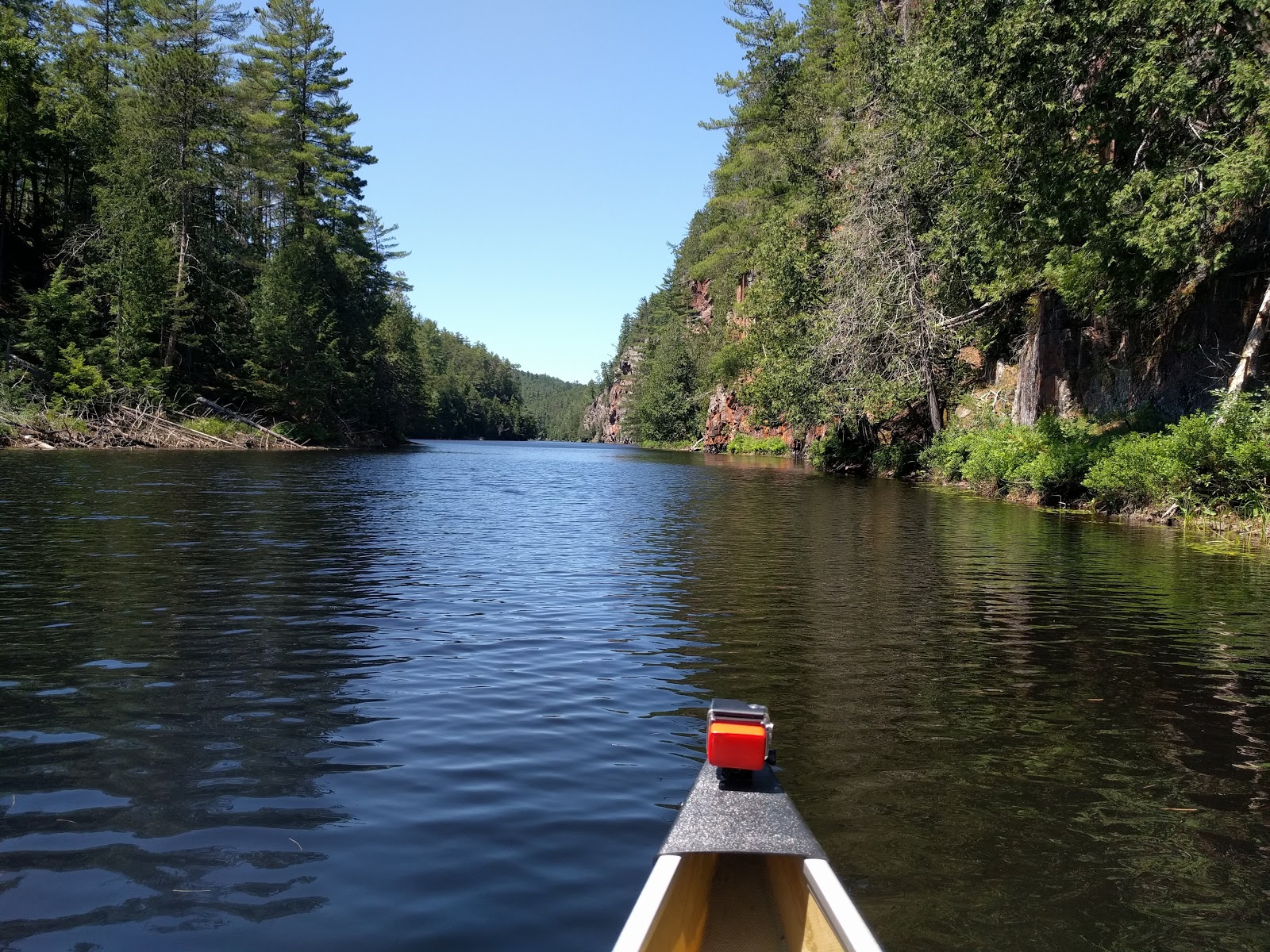
Our previous trip we only traveled down the Barron River. It's pretty awe-inspiring to look up at the tall cliffs. There's a trail at the top that we've hiked several times (see here for some photos taken up top). It's not a long hike and can be tacked onto most day trips to that part of the park. But we didn't hike it today.
In my opinion, I found the cliffs more inspiring on the way UP the river rather than downriver. We had the GoPro on the canoe, but I did not turn it on. It's tricky to manage once on the water. The buttons are on the front and I have to blindly guess if I've got it right as there are no indicators on the back of the camera. I know, excuses, excuses.
I pride myself on having a good memory. But I have to confess I did not have any memory of most of the route we did today. I seem to remember a big bay along the river that we never hit. The low water this year brought more rocks into range, so I was a bit stressed trying to watch out for them.
Here are some pictures from the first portage:


There are quite a few campsites along the river. One that stood out is the uppermost site. Some people were camped there and they had one of those suspended tents. It's not a good site for privacy though, you'd have to want to watch, and greet, all the traffic going by.
Here are photos from the trip up the river:


This portage is a bit treacherous as you climb up the bank and along the very edge. It's a bit of a drop to the river below and not much to grab onto. But we weren't fully loaded. I still had my trekking poles to help me up the hill.
We got to the chute and set up to have lunch and relax for a while. We only had one couple go through, at the very end of our stay, so it was pretty private.


Here's a short video of the chute:
For the trip down the river, L.T. turned the GoPro on. It doesn't seem as spectacular on film as it does when experiencing the trip.
Our paddle back down the river was quick. Not only were we going with the current, but the wind was at our back as well. The overall trip is about 17 km and very doable as a day trip. We were not rushed or worried in any way about time and neither of us were sore the next day from the paddling.
No comments:
Post a Comment