Showing posts with label hiking. Show all posts

Thursday, August 16, 2018

Day Tripping: Barron Canyon Paddle

Our very first trip camping we launched at Achray (Grand Lake) and paddled to the Squirrel Rapids access point. A one-way trip where L.T. arranged for his car to be moved. That was in 2014 and we decided that it was a good time to paddle the canyon again.

This is the first trip that we've used L.T.'s new vehicle, a Honda CRV, so we needed to learn how to best tie the canoe on. Spoiler alert, it took a couple of stops on the way home and several lost foam supports before it felt really solid.

On Sunday, July 8, 2018 we loaded up and headed to the Sand Lake Gate and parked the car at the Squirrel Rapids access point. Our plan was to paddle up to the second portage near Brigham Chute and walk up to that for lunch and a rest. We'd be paddling upstream on the way there and downstream on the way back.
Jeff's Maps
The access point is shown as A51 on the map above. We had one portage to carry over, a short one at 345m. We would only carry our lunch, chairs, etc. up the next portage, 440m, not too far either.

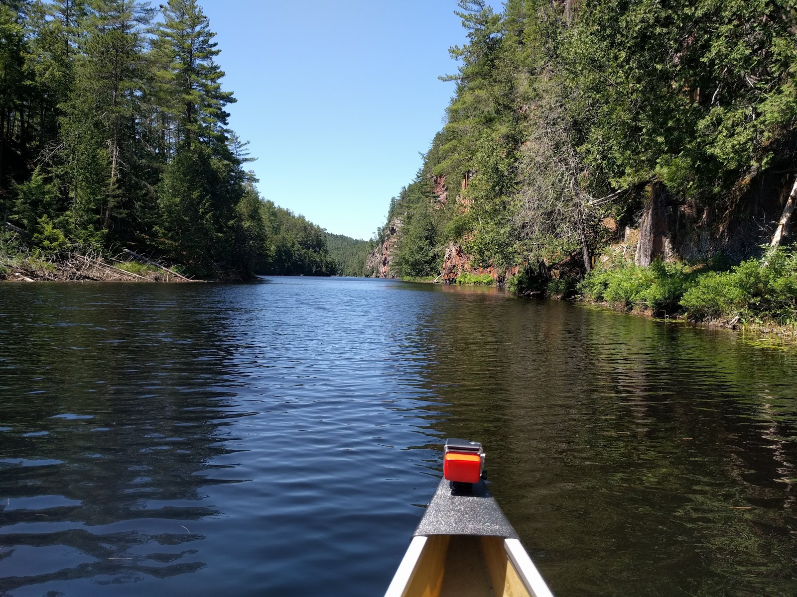
Our previous trip we only traveled down the Barron River. It's pretty awe-inspiring to look up at the tall cliffs. There's a trail at the top that we've hiked several times (see here for some photos taken up top). It's not a long hike and can be tacked onto most day trips to that part of the park. But we didn't hike it today.

In my opinion, I found the cliffs more inspiring on the way UP the river rather than downriver. We had the GoPro on the canoe, but I did not turn it on. It's tricky to manage once on the water. The buttons are on the front and I have to blindly guess if I've got it right as there are no indicators on the back of the camera. I know, excuses, excuses.

I pride myself on having a good memory. But I have to confess I did not have any memory of most of the route we did today. I seem to remember a big bay along the river that we never hit. The low water this year brought more rocks into range, so I was a bit stressed trying to watch out for them.

Here are some pictures from the first portage:


There are quite a few campsites along the river. One that stood out is the uppermost site. Some people were camped there and they had one of those suspended tents. It's not a good site for privacy though, you'd have to want to watch, and greet, all the traffic going by.

Here are photos from the trip up the river:


Once we were through most of the cliff area, we ran into a few canoes coming down the river. Well, they were stopped actually, waiting for some other canoes to catch up. 1, 2, 3 canoes. 4, 5, 6 canoes. 7, 8....you get the idea. Boy Scouts. Nice to see them enjoying the park. What was even better was that they were just finished up on the portage coming from Brigham Chute. The put-in is awful here, a pretty steep bank with no real shoreline to speak of. Our plan was to leave our canoe here and if we'd arrived with all those canoes coming out, well, that would have been a mess!

This portage is a bit treacherous as you climb up the bank and along the very edge. It's a bit of a drop to the river below and not much to grab onto. But we weren't fully loaded. I still had my trekking poles to help me up the hill.

We got to the chute and set up to have lunch and relax for a while. We only had one couple go through, at the very end of our stay, so it was pretty private.


Here's a short video of the chute:

For the trip down the river, L.T. turned the GoPro on. It doesn't seem as spectacular on film as it does when experiencing the trip.

Our paddle back down the river was quick. Not only were we going with the current, but the wind was at our back as well. The overall trip is about 17 km and very doable as a day trip. We were not rushed or worried in any way about time and neither of us were sore the next day from the paddling.

Thursday, December 22, 2016

Late Fall High Falls Hike

We didn't spend enough time in the park this year. The planning is already starting for next year though. In the meantime, we went for a hike in the park before the snow flew on November 19, 2016.

We stopped for breakfast at the gas station in Cobden. The place is always hopping so I figured the breakfast was good. It was meh and not cheap. It won't be part of any future plans.

We stopped at the Sand Lake gate to voluntarily drop off our vehicle fee for the day. The park office was closed for the season.

We decided to do the short hike up to the top of Barron Canyon. When we arrived there was a carload of people heading out on the trail. We took our time, gave them a good 10-15 minutes head start. As a result, we had the trail to ourselves.


As you can see, it was a lovely day for this portion of the hike.

By the time we got back to the parking lot, the first group was gone and a second group was preparing for the hike. 

We got back into the car and headed out to the cheater trail in to High Falls. I wasn't feeling up to the 20 km round trip and access was not available from Achray anyways. We did drive down the access road and met a locked gate probably a couple of kilometers from the trailhead. We turned around and went back to the parking lot for the cheater trail. The trailhead is just past access point A38 as shown in Jeff's map below:
Map portion from Jeff's maps
It's a 5 km trail one way, still challenging enough. I had my hiking poles and my small daypack. LT had bought a new backpack just for this trip. He got to carry the lunch. My crossbody bag is pretty tiny (yes, it was a strategic move).
Starting out on the trail
The woods were eerily quiet as we walked along the trail. It wasn't a bad temperature for hiking, we both had layers on. 
The portion of Stratton Lake near the falls
Once we got to the High Falls area, we hiked around to the part of the falls where the water starts down the natural waterslides. I had never been in that area before. Usually we're there with all the other people and we generally avoid the busy parts. 

Top of the natural waterslide

The natural waterslide that is so popular

We then wove our way down to the spot at the top of the highest waterfall and got settled in to have lunch. I had brought my day hammock and LT had his chair. 


The new backpack

Mmmmm lunch

Hanging by the top of the falls


The skies were getting darker by the moment. We hung out for probably an hour or so. Enjoyed our lunch, had a rest, then packed up and headed back down the trail.

I'm really surpised we didn't see any wildlife. I was anxiously hoping to finally spot a grey jay. It had just been nominated to represent Canada as our national bird. I had brought some black niger sunflower seeds to feed any birds we could spot, but we didn't even hear birdsong.

The woods got darker and darker as we got closer to the car. About 20 minutes away from the trailhead, we ran into the first people we'd seen on this trail all day. Three people and a rambunctious dog, which someone thankfully held onto as he was offleash. It was almost 4 o'clock and had started raining lightly. There's no way this group would make it to the falls before darkness fell. And by now the hiking wasn't much fun in the dampness. The only positive point was the lack of biting insects. 

It was a miserable, long drive home. It rained almost the whole way. Another year in the park finished for us. We didn't anticipate a repeat of last year's December paddling adventure

Monday, July 18, 2016

Hiking the Luskville Falls Trail

Last week I was able to schedule a hike with my friend, Liz. She had been on part of the trail many years ago so some of the trail was familiar to her. I had last hiked it about a year ago, okay, maybe 2 years ago. Even still there's been a few changes to the trail, predominantly trail maintenance.


They've put down stone dust in the parking lot, built a large map billboard with a roof, added boardwalks over potentially muddy spots in the trail and even added a couple of ladders. 

I've been here on a busy weekend day in the fall, there were cars parked on the entrance road, so many people hiking! They almost could have enlarged the parking lot. Today it was busy enough and we were often bumping into others on the trail. Everyone is friendly and says hello.

To get to this trail, you need to take highway 148 West out of Aylmer. You get to the turnoff when you are close to Luskville. Turn right on the road right where the old town hall sits, "Hotel de Ville".

There are outhouses at the parking lot with some picnic tables.

It's a high climb, 300 meters up in the first 800 meters distance of the trail. There was lots of huffing and puffing going on!
The stream flowing down a rock face
More rock face
Some of the trail
Looking down the trail
My hiking buddy, Liz
The trail is about 2.5 km from the parking lot to the fire tower. There's a second trail for a portion of the hike if you want to take a different route. However it was closed for us today. I guess they're working on "improving" it.
The last lookout before heading in the woods to get to the peak
The apex of the trail
Close up
At the fire tower the trail connects with the #1 trail for Gatineau Park. However it's a long, long way to get anywhere close to civilization on that side of the mountain. I think it's mainly used by mountain bikers.

On the way down, we stopped by the stream for a break. I took my hiking boots off and enjoyed the cold stream on my feet, mmmmmmm.
Chilling the piggies
I found it easier to climb, much harder to go down the rocky trail. I had my hiking poles and the next day my arms were more sore than my legs. However, during the hike we were both suffering from spaghetti legs. I hope the next time I ask Liz to come for a hike, she'll join me. I promise there won't be so much of an uphill climb! She was a great sport and I've talked her into joining me on a backcountry canoe trip in a week or so. Stay tuned for that adventure!

P.S. some pictures are courtesy of Liz, thanks!